About the cover photo: It took me three attempts of between 4 and 5 days each to get into the spot where this photo was taken. On the first two trips I suffered some very painful injuries. This spot is in the Baker River drainage in North Cascades National Park. Do you know the name of the mountain?

Converse hightops on my feet, I traverse the North Cascades in pursuit of my life project to walk into every high lake or pond mapped in the Skagit River watershed. The upper Skagit Valley near Marblemount, WA is my home and has been home to my family since 1888. I have come to feel that the culture of this place, like the culture of much of rural America, is misunderstood by an increasingly urban population and threatened by economic depression. I would like to share the stories of this place and the people who call it home. Through my stories and images of these mountains, my goal is to help others understand and respect both the natural resources and the people of the North Cascades.


Monday, June 30, 2014

Lesser Known History of the North Cascades Vol. VIII


State Route 20 (North Cascades Highway) Milepost 113 cont.

The bottom of The Portage is just upstream of the bridge piers to the abandoned Skagit Talc Mine, maybe a half mile upstream of Milepost 113 and it ends at about Milepost 114. This spot was called The Portage because in the old days when everyone got around by canoe, it was the only spot in the river where you had to portage your canoe. The rest of the river was navigable below that point and above that point to The Gorge at Newhalem.

Though you had to portage your canoe up around this spot in the river, I have been told that, if the river was right, and you knew what you were doing, you could get back down through it in a canoe. I imagine portaging one of those dugout canoes was a lot of hard work so any extra portaging you could avoid would be worth it, as long as you stayed alive. If the river wasn’t right or you didn’t know what you were doing, you had better portage back down through this spot too. Over the years, at least since European American settlement, and I imagine for the preceding millennia, a lot of people were drowned trying to get down through this spot.

One of the more interesting stories passed down by my dad involves a canoe full of Chinese, probably coming down from one of the mines upstream. The canoe didn’t make it and everyone drowned. Supposedly they were finding these poor Chinese guys, or what was left of them, all along the river for several years after.

There has been a good bit of information written about The Portage, I believe, but I don’t know about the Chinese. My dad also had a story about three Chinese guys who got out of the country with about 10,000 dollars in gold. The story goes that these guys kept quiet about it and pretty much just disappeared from the Upper Skagit one day. Those times were pretty rough I think with a lot of bad people around who wouldn’t think twice about killing someone for their money. Add to that, in those days there was a lot of anti-Chinese sentiment and people wouldn’t think twice about killing Chinese. It was probably illegal but unlikely to be prosecuted, depending on where you were.

When the railroad came through there was a spot along The Portage called Shovel Spur and the area is generally referred to by this name today. Shovel spur got its name because the tracks were constantly being covered with slides in this spot so a spur was built nearby to park a steam shovel to clear the tracks.

According to geologists, thousands of years ago there was a natural dam on the river in this area. Evidently a large landslide dammed the river and formed a lake (Lake Ksnea) for many, many years, hundreds or maybe thousands. The rapids at The Portage/Shovel Spur flow over large boulders deposited at least in part by the slide (there is bedrock at the top of The Portage that might be the source of some of the boulders) and I don’t doubt that the remnants of the material that formed the landslide dam contribute to the unstable soils in the Shovel Spur area.

At the top of The Portage, just a little west of Milepost 114 there is a sharp corner in Highway 20. There was a sharp corner in the tracks here as well because the present highway follows the old railroad grade. In the railroad days, this corner was called Devil’s Elbow because trains frequently derailed here.

A little over half a mile east of Milepost 113, you can see the remnants flat surface of an old grade trending uphill in the woods off the west bound lane of Highway 20. This is the old road up the valley. It goes up and over a big hill while the railroad, which needed to maintain a low grade, stayed down by the river. During the Second World War, there was a guard shack on the road at the top of the hill.

Just short of Milepost 115, Highway 20 crosses Damnation Creek. Damnation Creek is so named because in the days when there was just a pack trail up the river, they packers going in to the mines would ask the guys coming out of the area what “that creek about nine miles up was doing”. A common answer was that “it was running all over Damnation.” At some point the name stuck.

If you look above the west bound lane of Highway 20 in this area, you will see large deposits of gravel and small boulders with a number of stream channels beside, some dry, some wet in addition to the main stream channel. The large sediment deposits are likely the result of the stream rapidly exiting a very constricted channel just above the lower run of Seattle City Lights transmission lines. This is probably coupled with some factor, rock competency, a fault line, etc. that makes the bedrock along the stream channel highly erodible. This area is also within the landslide mentioned earlier in association with The Portage which would probably result in a lot of highly erodible material in the area.  

Over the years, the State Department of Transportation has had a number of problems here keeping the creek in the main channel so it will flow under the bridge like it is supposed to. Several bridges have washed out here. When I was a kid, someone in the DOT or some other agency that had the power over the DOT took offense to the word Damnation.  The road sign was changed to Darnation. It lasted less than a week before disappearing. Another sign went up and came down just as quickly. The DOT went through several signs before giving up and putting the Damnation Creek sign back up. At some point many of the stream signs have been removed. There hasn’t been a sign naming Damnation Creek for quite a few years now.

This post will end this series of lesser known history. There is much more I could write about on the same theme of lesser known history along The North Cascades Highway, Highway 20, going almost all the way to Rainy Pass.

Looking downstream near the bottom of The Portage at the bridge piers for the bridge to the abandoned Skagit Talc Mine. 

Close up of bridge pier on left bank (south side) of river.

Looking upstream from spot previous two photos were taken. 

Near the top of The Portage. 

Near the top of The Portage. The rock in the foreground is man made riprap placed to protect the road from erosion by the river. The rock on the other side of the river and in the river, causing the white water is naturally occurring. 

At the top of The Portage. 

Sunday, June 22, 2014

Lesser Known History of the North Cascades Vol. VII


Highway 20 (North Cascades Highway) Mile 109.5

The last Lesser Known History of the North Cascades post (Vol VI) left off at about Milepost 109.5. About half a mile east of Milepost 109, Highway 20 intersects the old railroad grade and it now follows it’s bed for about half a mile to a little past Milepost 110. Just east of this intersection the highway, and the railroad before it, passes under some bluffs on the westbound lane.

I think it was from these bluffs that my uncles, when they were kids (probably 7 or 8 to early teens), threw rotten eggs at the Seattle City Light tour trains, which goes to show you that young boys are quite often obnoxious, regardless of era. I also know that they had to work pretty hard around the place so it goes to show that young boys will also spare no effort and go out of their way to be obnoxious. Fortunately I think the egg throwing was a rather short lived enterprise.

At some point, before they abandoned this nefarious pursuit, they decided to pull out all the stops on the egg throwing. They devised a giant slingshot built from two cedar fence posts for a frame, two entire truck inner tubes for the elastic bands and the entire tongue of an old boot for the pouch. The whole scheme fell apart when they test fired a potato in the slingshot.

The potato beaned my grandpa, who was working out of sight over a small hill, in the head and knocked him out cold. When he came to, he was mad as a hornet. My Uncle Nick, who was a little older than my dad had been the lookout for the whole operation. Of course, the last thing Grandpa saw before the lights went out was Uncle Nick up on the hill looking at him. Undoubtedly this led him to believe that Uncle Nick had thrown something and hit him. I understand that Grandpa and Uncle Nick didn’t get along very well to start with and this incident didn’t end well for Uncle Nick.

I’m sure that, at some point, Grandpa figured out that there were more involved than just Uncle Nick but Nick was the one that got punished for it. Grandpa was so mad that he destroyed the slingshot by tearing the posts out of the ground with his bare hands. He had to have been around 70 years old at the time.

My dad was too young to be involved in any of this beyond witnessing it. Dad wasn’t an angel. I’m sure he would have been in on the egg throwing and slingshot building too but he was too little. He worked 29 years for Seattle City Light before retiring. I remember him telling this story and often commenting how awful it must have been for the folks from Seattle and other far away places to come all the that distance and have their good clothes covered with rotten eggs. I understand that, after the slingshot incident, there was no more egg throwing.

Milepost 110

Milepost 110 is just past the eastern end of the egg throwing bluffs. If one looks closely, you can see the old railroad grade on the north side of the highway and a little above it. The highway here goes down a small hill.

About a quarter mile or a little less, there is a slough in the river on the south side of the road (off the east bound lane). This is called Charlie’s Slough. I don’t know the story behind the name. Actually, I should say that I don’t remember. I asked once and I think I was told but I don’t remember.

About half a mile east of Charlie’s Slough is Bacon Creek and just east of it, Bacon Creek Road and Leonard Bacon’s Place and Milepost 111. The Bacon Creek area is well covered in my Know Your Forest, Bacon Creek post of 12/11/13.

About a quarter mile east of Milepost 111 there is a patch in the highway that doesn't get any sun during the short months of winter. The shaded spot is perfect for forming black ice under the right conditions and there have been a lot of car crashes here over the years but no fatalities come to mind. The DOT now keeps this area well sanded during cold spells in the winter months.  

About half a mile east of Milepost 111 there is a road intersecting the east bound lane that leads to the Copper Creek Boat Launch and a Seattle City Light sand pit. And about a quarter mile east of that, one enters the Ross Lake Recreation Area. The monument on the road now says North Cascades National Park which is technically true because the Park does administer the Recreation Area as part of the North Cascades National Park Complex but the land use rules are different in the Recreation Area than in the Park.

The situation has always been a bit confusing but it is nice to have a Recreation Area where the rules, while they are certainly more stringent than on Forest Service land aren’t as strict as in the Park proper. The Recreation Area was created when the Park was created because there was already some development in the area and as a concession to local people who, at that time, depended, at least to a degree, on the ability to use the natural resources of the area for their livelihoods. Many of us still use these resources regularly. With a few exceptions, rules prohibit almost all use of natural resources in North Cascades National Park proper. I understand that they have renamed the Recreation Area to North Cascades Recreation Area rather than Ross Lake Recreation Area in an effort to clear up some of the confusion.

Milepost 112

Milepost 112 is about a quarter mile east of the Recreation Area boundary. About a quarter mile east of this milepost, Alma Creek flows into the south bank of the Skagit. The Alma Creek valley is quite visible from the highway at this point though the creek itself enters upstream of a corner where the road trends away from the river, so it is nearly hidden.

My dad told me a story passed down by his dad about an Indian battle that occurred at Alma Creek. It was between the Skagits and a band of Indians down from Canada (maybe Lower Thompsons). The fight was over an iron cook stove. The outcome of this battle wasn’t passed along in the story. For the Canadian people this would have been quite some distance down the river from at least one of the traditional territorial boundaries that I am aware of which was at Stetattle Creek in the present day town of Diablo.

 The other story I have about Alma Creek doesn’t necessarily concern that particular spot other than it was the starting point for a compressor base that my grandpa packed into the Skagit Queen Mines up on Thunder Creek.

Supposedly this compressor base weighs a thousand pounds and has the weight stamped on the base of it and my grandpa and four other men packed it in there on a big black horse. The story goes that the compressor base was the only part of the machine that couldn’t be made smaller to pack into the remote location.

If one looks at a lot of the big parts of equipment that were packed long distances in those days, one will see that parts such as wheels that, ordinarily, would be one solid piece have been broken in several places and bolted back together. Wheels were probably broken rather than cut so there would be a unique break line that would only match perfectly one way. This insured that, when the wheel was reassembled, it would still retain its balance. Or maybe they were broken rather than cut for other reasons.

As I previously stated, this compressor base couldn’t be reduced to smaller parts so it had to be packed in one big chunk. The base was brought up the river to Alma Creek. I don’t know if this was in a steamboat or canoe. From there my grandpa and the five other men, or more accurately, the horse, packed it into Skagit Queen.

As the story goes, Grandpa rigged the pack saddle or maybe some unique contraption that wouldn’t be immediately recognizable as a pack saddle, in such a way that boards could be slid horizontally under the load and perpendicular to the long axis of the horse. That was what the four other men were for. Each one carried some boards and was assigned a corner of the load. When the horse got tired, it would bow its back and a board would be passed under the front and back of the load perpendicular to the long axis of the horse. Then each man placed a board upright under his end of the horizontal board under the load to support this board and the load on top. The horse would then sag into the pack saddle and rest. When it was ready to go again, it would bow its back, the boards would be removed and it would go up the trail until it was tired again whereupon the process would be repeated.

They got that compressor base all the way into the Skagit Queen Mines without killing the horse. Quite obviously this was a smart horse. And, evidently, Grandpa knew its capabilities to a fine degree. Along the trail, he chose spots to stop for the night that were well within the capacity of the horse to travel in a day carrying such a load  and where there was a suitable tree to offload the compressor base.

I have had people call B. S. on this story. There is a book written on the old mines in the area that seems to mention this compressor. The explanation of how it (or some very similar piece of machinery) got to where it still sits today is rather vague, something like getting the biggest mule they could find and dragging it in by brute force. Evidently the author didn’t talk to anyone in my family..

This compressor base, with the rest of the compressor, still sits next to the Thunder Creek Trail a short distance above where the trail crosses Thunder Creek on the way to Park Creek Pass. I wasn’t there when it was packed in and I don’t know a whole lot about horses and packing. But I can tell you one thing. It wasn’t flown in by a helicopter because such a machine didn’t exist in those days.

I have heard of horses and mules that can pack up to a thousand pounds. I have it on good authority that there is at least one mule in this day and age that can pack a thousand pounds for a about a mile.

And one should consider that, in the days when a lot of things were packed long distances over difficult terrain, people knew their animals to a much greater degree than people do today. In those days, many people depended on their animals for their living and worked with them daily. It paid to know how much a given animal could, or couldn’t, do because sometimes it could mean life or death or loss of a means to make a living. One only has to read books from the 19th Century or prior, before the invention or widespread use of automobiles, to pick up that even the average person of those days could evaluate a horse or mule in much the same way as someone today would evaluate a car. I couldn’t evaluate a horse or mule in such a way.

And I would not at all be surprised if a lot of the traits useful for a work animal have been lost to some degree today. A big animal with a lot of muscle to fuel is going to eat a lot of feed and, if you aren’t using it for work, what good are those traits? The valuable work animal of yesteryear is today’s hayburner. It is also possible that these traits may have been lost simply because they were no longer important.

Finally, whatever rig my grandpa had set up it sounded like a custom job, not to be found in a standard packer’s manual of today. My dad told me the story and he grew up around horses and mules and was familiar with livestock packing. So, if it was a common or standard rig, my dad would have been familiar with it and would have referred to it by name. He did not.

It is possible that it could have been a rig that was well known in those days for oddball type loads that has been lost or not well known by my dad’s time, again, due to the lack of a need for such a thing when automobiles became prevalent and later helicopters which are both cheaper, faster and can move more weight. At any rate, the description of how the rig worked makes perfect sense to me whereas I have heard several modern day packers puzzle over how they could accomplish the task with the rigs that they are familiar with. The machine is there, still fourteen miles from the highway. The reader can decide how it got there.

Back to the lower part of the valley. Across from Alma Creek, the road cuts into the forest and away from the river (actually it is the river that is flowing towards the road at this point). About where the highway enters the forest from the opening created by the river bend a small stream flows under it. This creek is named Talc Creek for nearby talc deposits.

Evidently, years ago, the old road here was a problem spot and very slick, according to my mom. I don’t know if talc was incorporated into the road surface or was deposited on the road surface frequently when the creek flooded over the road. The road here has also been problematic, constantly sagging either from the river bend below or maybe a lot of talc incorporated in the road fill.

There are several old talc mines in the area but due to the area’s status as a Recreation Area, minerals, including talc are not allowed to be removed.

A little east of  Talc Creek the road trends a little south in a long curve, following the route of the old railroad. The car road actually followed a straighter line through this area and is now overgrown with forest. When I was a teenager, 30 years ago, the asphalt road surface was still walkable through this area.

There was a railroad siding in this area named for the logging company that it was built for, Jennings and Nestos, sometimes you will hear an old timer refer to it as Jennings and Nestos Siding but often it is shortened to just Jennings and Nestos or Jennings Siding by the few remaining folks who still call it by that name. For years I thought it was Jennings and Estes, because I knew quite a few folks named Estes, until I saw it spelled. I also thought the term siding referred to the type of siding you put on a house, not realizing that it was a railroad siding.

About three quarters of a mile east of Milepost 112, Highway 20 crosses a small creek. The name of this creek is Tilt Creek. The whole general area where the highway follows the old railroad grade is generally known as Pinky’s.

Pinky’s is named after a man named Pinky Hendrickson who had a house near Tilt Creek. It is called Pinky’s even though he and his wife, Rosella, got the property from Rosella’s mother.

Somewhere in this area, my dad, in his youth, around the Fourth of July got into a little trouble. It seems that he and several of his friends, possessing an abundance of firecrackers, decided to play some tricks on passing motorists. There was a spot in the road where cars had to slow down and that is where they carried out their ambush, lighting firecrackers and throwing them into the road so they would explode at the precise moment the car was over the top of them.

This went fine for a while, at least from the point of view of a delinquent kid, I am sure they were having loads of fun, I doubt the motorists were quite as amused. Then one night of the cars they ambushed suddenly screeched to a halt and a man got out with a hatchet yelling “C’mere you little b_____ds. I’ll cut your heads off.”

Of course Dad and his friends scrambled to hide. I think it was after dark so this helped. The hatchet man stumbled around quite a while looking for them and screaming that he was going to cut their heads off. Dad said they were hiding under logs and behind stumps and brush. I think the guy actually walked over one or two of them without seeing them.

Finally, he gave it up, went back to his car and drove off. Would he have killed anyone he caught? I don’t know. I don’t think Dad was sure either. I think this incident probably put a damper on their car ambush activities but I am sure, in their vigorous youth, it wasn’t long before they were up to some other mischief.  

Milepost 113

Milepost 113 is near the east end of the old railroad grade and the old car road grade meets the present day Highway 20 about where Seattle City Light’s south transmission line crosses the highway and the river.

About a quarter mile east of Milepost 113 and a little upstream of where the transmission lines cross the river there are some big bridge piers in the river. They used to be quite visible from the highway but the trees and other vegetation have grown up and hide it now.

This bridge was probably originally a railroad bridge retrofitted for automobiles. The log stringers for the bridge were blown out sometime in the mid to late 1960’s. You could still see a few in place when I was a kid.

This bridge led to a mine, the Skagit Talc Mine and some logging units on the other side of the river. I have a few stories about the talc mine. My oldest uncle, C. H. (Charles Henry), worked there. At that time, the talc was being cut up for steel marking chalk in the shipyards. Chunks or crayons of talc are still used for this purpose today. I think they also used talc from this mine for firebricks in foundries and the like. And they cut one very big piece to be carved into a bathtub for some rich guy in Seattle.

The mining method was very interesting in those days. They had saws that they used to cut slabs out of the talc deposit. The slabs were then sent to a mill on site where they were sawed into the steel marking crayons with a saw that I have heard was invented on site specifically for that purpose or at least it was invented for use in that specific site.

C.H. was killed in that mine when he was 21 years old. The story goes that a slab fell on him and crushed his legs. In those days the only rapid transportation was the railroad. The nearest doctor was in Rockport, the nearest roundhouse where the train engine could be turned around was in Newhalem. So they had to take the train to Newhalem, turn the engine around and come back to get my uncle. By the time they got him to Rockport he was dead. It is likely that they wouldn’t have been able to do anything for him anyway. If he had survived, he undoubtedly would have been crippled for life in an era where everyday life was not kind to people with disabilities.

I don’t know a lot about C.H. beyond a few stories here and there. He didn’t have any children and he died just before my dad was born so my dad didn’t even really know him. He was named after my grandma’s dad. Rosella, who grew up there said he used to stop by their house to visit all the time. It seems that he really liked kids and she said he told great stories. I guess they took him to their house after the accident to wait for the train. Rosella nearly broke down talking about it many decades later. A few years back, I was reading in one of my grandma’s journals about C.H. when he was still in diapers and I got a kind of odd, sad feeling. We still have a egg cup that C.H. carved out of talc from the mine.

Albert Merrit, my neighbor across the street also worked in the Skagit Talc Mine after the Second World War. In those days, they just shot the talc and shipped it off to be ground into baby powder. He told me that they had a routine. They got so much per ton and they could make decent money by spending about the first half of the day drilling and loading the holes and shooting (blasting) the talc (they had delays between each hole so they could hear and count them separately to make sure all of the charges went off) and then spending the rest of the day loading up the carts (mucking) and dumping them. He said that they made decent money but they were never going to get rich.

He worked with his step dad, Herman Smith who my folks and their friends bought the Smith Place from. I mentioned the Smith Place earlier as the property where the Diobsud Creek road meets Highway 20 (Vol VI). Herman was an expert hard rock miner and had worked many mines in throughout the west.

Al told me a good story about another mine in the same area as Skagit Talc. There was a guy from Bellingham named Pat who was mining for another outfit though undoubtedly in the same deposit as the Skagit Talc Mine. The tunnel Pat was working was down near the bottom of the hill where the main mine was I believe. Pat would work a regular week and then go back to Bellingham for the weekend.

As Albert told it, the outfit who employed Pat only paid him for how much talc he produced, not for timbers and the time it took to put them in. So evidently Pat skimped on the timbers, probably so he could make enough for a decent living. One Monday Pat came back from his weekend in Bellingham to find that his tunnel had collapsed with all of his equipment inside. Al said that Pat just turned around and went back to Bellingham and never came back.

Something similar happened at the main mine. Sometime in the late 1960’s or early 1970’s (the date is recorded but I don’t have the reference handy) the guy who owned the mine decided to shoot the whole area and do an open pit. There was more overburden than he expected, evidently too much to make it economically feasible to keep working the mine. So it was sold. I don’t know if it went directly to the National Park Service or passed through other hands before the Park acquired it. It is now illegal to take materials and artifacts from the mine site.  

Just east, up the river from the talc mine site and on the same side of the river (south) as the mine site, there is another creek. This is also called Talc Creek. Talc Creek enters the Skagit River at the upstream end of The Portage which I will cover in the next post. 

Saturday, June 14, 2014

Lesser Known History of the North Cascades Vol. VI


Highway 20 (North Cascades Highway) Milepost 106

Milepost 106 on Highway 20 is in the middle of the town of Marblemount which I covered in the last post. About a quarter mile west of the Community Hall/Fire Station/east boundary of town, the road goes down a small hill. This is one of the first places the river comes over the Highway during floods. There is a back way around it up either Emerald Lane or Honeysuckle Lane and then under the power lines and out Ranger Station Road.

This is also the spot where, according to my dad, Olson Creek used to flow into the Skagit River. If you know what you are looking at, you can see old stream channels and swales here that were formerly the bed of Olson Creek. It now meets the river on the other side of town and downstream of the Cascade River.

In the fall of 1983, just after I graduated from high school, some friends and I were snagging humpies (pink salmon or Oncorhynchus gorbuscha) in the Skagit near here (snagging or jigging for salmon was, and still is, illegal by the way). On the way back from the river I stepped on a nail, driving it into the bottom of my foot. This necessitated a visit to the emergency room in Sedro-Woolley where the wound was cleaned and flushed out and a tetanus booster administered.

That evening, or maybe the next day, I had to go back down to Concrete. I was trying to get back a Sammy Hagar tape (Standing Hampton) that I had lent a friend who was living with his grandma. This guy was out of town so I stopped by his grandma’s house to see if she might know where my tape was. She met me on the porch and about the first thing she said after “Hi” was, “I heard you hurt your foot”. Understand that I hadn’t seen or talked to this lady all summer long. Word gets around fast in a small community. I didn’t get my tape back.

Just a little farther west of the low spot in the road and the former Olson Creek channel is the site of the house of some friends. I remember this house burning down one morning when we were kids. The school bus I rode would have ordinarily have picked up the kids who lived there but they were all outside in their bedclothes with bedding in hand looking at the house which was a solid mass of orange flame. It was awful. Fortunately everyone got out okay.  

Several hundred yards farther east there is a house that appeared to made of vertical logs. Dad told me that the guy who built it went to one of the local sawmills (there used to be a lot of them) and picked through the scraps to get half-round boards of a uniform width. In those days the first and last cuts in on a log were thrown away or burned as waste because they were-half round. This guy built his house out of the half-round mill scraps. The house was painted a pale pastel yellow that wasn’t very flattering but I always thought the overall architecture of the house was pretty interesting. I have seen a few similar houses but not many. Some years back some people bought the house and put a bat and board exterior on it.

About a quarter mile farther east along Highway 20 there is a house with a man buried in its front yard, if my dad is to be believed. My dad called this man Skiyou Jack and dad had a story about him that, though it was kind of funny from a certain point of view, wasn’t very flattering. I have never told anyone else this story and I don’t think I will ever share it because we all have problems and there had to have been more to the man’s life than one unflattering story.

There was a tree, I don’t remember exactly what it was beyond that it wasn’t native to the Pacific Northwest, in the front yard of the house and Skiyou Jack was buried under that tree. Ten or fifteen years ago whoever was living in the house at the time took the tree down and removed the stump. Evidently they didn’t find any bones or, if they did, they didn’t talk about it. The soils here are pretty acidic so there might not have been any bones to find. I doubt any of the occupants over the last decades ever even knew about Skiyou Jack.  

Another hundred yards or so east along the highway, one will see a stand of Douglas-fir with the largest trees at maybe 40 to 50 feet tall and 12 to 18 inches dbh (diameter at breast height). This is a Christmas tree farm that got away. The trees were planted in a field there when I was probably in my teens but they never got harvested and so continued to grow. They appear to be just another forest until one looks and sees that there is nothing there but Douglas-fir and they are all roughly the same size.

Milepost 107

Milepost 107 is just east of the feral Christmas tree plantation. About a quarter mile, or maybe a little farther, east of Milepost 107, Emerald Lane intersects the west bound lane of the highway. Emerald Lane was built when I was 16 or 17 years old for access to a development. There were no houses in this area at that time, it was all woods.

Emerald Lane leads back to the Seattle City Light transmission right-of-way that, in this area, is also the old railroad grade, and across this to the old air strip that Harlan Blankinship built. As I previously stated, the airstrip is now overgrown where there aren’t houses and lawns. I remember me and a friend of mine racing our dad’s pickups along Emerald Lane just after it was built and before it was named. This was while I was still in high school. I also had a very bad experience deer hunting at the air strip before there were any houses back there. When the river floods, Emerald Lane or Honeysuckle Lane are the only way to get into Marblemount via the road, which is the old railroad grade, under Seattle City Light’s transmission lines.

A few yards east of Emerald Lane off the west bound lane of the highway a flat topped house sits just above the river. This house is remarkable in that, since it was built, to my knowledge, it has never flooded even though it only sits 10 or 15 feet above the river. There is a wide flood plain on the side of the river opposite this house and this flood plain is at a lower elevation than the house so all of the water goes over there during floods.

A little less than a quarter mile farther east, if one looks closely as you pass by, off the east bound lane on the river bank, there is one of the few remaining old growth Douglas-firs in the valley bottom. It is at least 5 feet dbh or more. It has a hard lean straight out into the river. I’m guessing this is why it was never cut. In the days the timber of this size was being cut, they were still using axes and crosscut saws and there was probably no way to keep it out of the river when it fell, at which point, they would lose it, and the several hours of very hard work that it took to cut it down. So it was left.  

About another quarter mile farther east, off the west bound lane there is a small house that now has trees growing through it. When I was a kid, I nice old couple named Carl and Lucille Estes lived here. They operated a small farm between this house and a small field, maybe a couple of acres in size, another quarter mile farther east. I don’t remember exactly what all the different types of animals were that they had but I definitely remember 
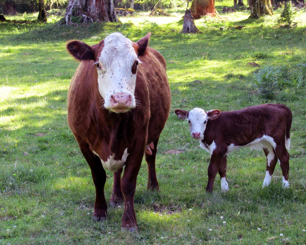
chickens, goats and a milk cow.

It was obvious that these folks weren’t wealthy but Lucille always seemed to have enough set by to buy a couple magazine subscriptions from me every year during the magazine sales drive when I was in grade school. I think the sales were a national cooperative thing between schools and big magazines to teach kids sales skills and work ethic. All of the subscriptions were for large national publications.

Milepost 108

Less than a quarter mile east of Milepost 108 off the east bound lane is Estes’ old field. There are some houses and other buildings here now that weren’t here when Estes’ owned it and a row of tree has been planted between the field and the highway. Directly across the highway from the field is Honeysuckle Lane.

Honeysuckle Lane leads back to the Seattle City Light power transmission right-of-way and old railroad grade on top of a bench or terrace. The road leads across the right-of-way and up to another bench but it is now gated at the bottom of the hill.

My dad was born in a cabin that stood near the intersection of Honeysuckle Lane and the right-of-way. The road wasn’t called Honeysuckle Lane at the time and it led through empty forest land. The name Honeysuckle Lane was given, probably to add appeal to the area, when the land was developed for houses. Ironically, dad ended up working for Seattle City Light for many years on the power transmission right-of way. One of my aunts, named Betsy, is buried up there. She died of diptheria when she was nine years old. There is more on this place in my post, Walking the Dog of June 5, 2013.

About half a mile east of Milepost 108 Highway 20 crosses Diobsud Creek. There is a field beginning to become overgrown with trees and a blue-gray Victorian farm house on the west side of Diobsud Creek off the east bound lane. There is a small scar on my left eyebrow where it joins the nose that I got from falling off the porch of that house. When I was younger, we knew a lot of people who lived in that house and I spent a lot of time in it, though it has now been 30 years or more since I have been in it.

Diobsud is an Indian word. Dad always said it means “foaming water”. I have heard other people say that Diobsud was the name of a chief who lived near there but the real Native word for the stream, which was not Diobsud, did mean “foaming water”. I have also heard that Diobsud means other things as well. No matter what the name was, I have always liked the meaning “foaming water” because this is a stream where you can pretty reliably find foam where the stream flows out of a constriction at the valley wall.

None of the people I have talked to who still understand Salish were familiar with the word Diobsud. The closest term anyone could come up with means “the other side of the river” or something like that. I wonder if the word was actually a term used only by the local band or sub-band of Skagits who lived in the area. There were quite a few separate bands along the river, each with its own name, and I would think, possibly with their own colloquialisms and local place names. These people collectively became known as Skagits at some point later, probably under a treaty of some kind. I’m not an expert on that history but it doesn’t sound like a very good time for Indian people when the white people moved in, though many were able to and did continue to live in the area.  

The proper way to pronounce this name, as Native speakers did, as per my dad who heard Native speakers say it is: Die-oh-b-sud. People who grew up here usually say Die-oh-b-see or Die-oh-p-see. People who didn’t grow up here rarely get it right. I am sure it will morph into something unrecognizable to the original before too many years pass. Such is the way with some words but it is also kind of a shame to lose this little bit of history so unique to the place.

If you look upstream on the creek at the west side of the bridge you will see a riprap dike that is now so overgrown with trees that it is hard to recognize. A large hole was made in this riprap dike just upstream of the bridge to allow a side channel to flow through.

When I was a kid, they had trouble keeping the creek under bridge where it was supposed to be. This was because they made the bridge too small for the stream channel. To fix the problem, they made the riprap dike on the west side of the creek. The creek promptly found a way around the upper end of the dike, during a spring flood, I believe. Now the dike was in the way of the stream flowing back into it’s original channel so it flowed across the road and the field and I think even the Victorian house that I previously mentioned. The breach was made in the dike so the creek would flow back under the bridge and it has been that way ever since, about 45 years or so.

Diobsud Creek in the area of the Highway 20 bridge continues to be a problem. When the original bridge was built here, the engineers made it too small, probably because they came up and did their measurements and calculations in the summer or at least when the weather was nice and Diobsud Creek  was at low flow conditions, not during flood stage when high stream flows filled the stream banks to capacity. The bridge being too narrow creates a constriction which causes the stream above the bridge to store sediment and meander all over the place for quite some distance upstream.

There is a field on the east side of the bridge on the north side of the road that has been eroded away to almost nothing. This field has lost at least an acre, probably more. There used to be a pretty healthy fringe of trees between the field and the creek. The creek undercut some of these trees and they fell in and the stream migrated east around the root wads, causing even more trees to fall in, pushing the creek into the field and preventing it from flowing back into its original channel.

The land owner was not allowed to cut or remove the trees that were causing the stream migration through his field and towards the highway. This is a good example of what I call environmentalist dogma at work.

Logs or large woody debris are generally a good thing in a stream. Large woody debris helps prevent erosion, stores sediment and creates lots of habitat for fish and other aquatic organisms. Over the years, a lot of logs have been removed from streams to the detriment of said fish and organisms. Therefore, some very strong rules have been adopted to prevent people from cutting or removing large woody debris from streams. This is what happened on the east side of Diobsud Creek.

However, the problem here was, first, the bridge is too small, causing the stream to migrate more than usual and second, in this situation, the fallen trees were actually increasing erosion. Usually when a tree falls into a stream the resulting log then somewhat armors the bank it fell in from and prevents further erosion by preventing the full force of the water from further hitting the bank. On some occasions, however, the stream cuts back behind the fallen tree. In this situation, the stream is prevented from reentering its channel by the newly fallen log and continues to erode away from it. I have seen this happen under natural conditions in several streams that I have surveyed over the years. These streams sometimes moved hundreds of yards, mowing down forests as they went. This is the situation that existed on the east end of the Diobsud Creek bridge.

Because the rules prevented cutting or removing the logs and the dogma says that large woody debris is good, no matter what, Diobsud Creek continued to erode away from the channel that went under the bridge. It was moving through the field towards the highway. If it had reached the highway and washed it out, then there would have been a lot of asphalt, and oil and grease in the creek and the river. Fixing the highway would have created a huge mess and a lot of sediment in the stream along with more oil and more grease, definitely a lot more environmental damage than would have resulted from cutting a few logs out of the creek and maybe a little riprap on the bank. I agree that large woody debris, as a general rule, is good to have in streams. Situations like this are the exception to that rule. A few years back the land owner was finally granted permission to cut a path for the creek to flow through the log jam rather than continuing towards the road. ‘Nuff said.  

About half a mile east of the Diobsud Creek bridge there is a sharp corner. The place on this corner is where I grew up and the home field that I erstwhile hayed and pastured the cows on during the winter. There is an old house here, built during the Great Depression. More on that later.

This spot is a nice scenic pastoral place with a field with a backdrop of mountains. Except for the six years I spent in the U.S. Navy, I lived here from the time I was about a month old until I was 46.

Always there is the sound of water, Diobsud Creek to the north and the Skagit to the south, rustling at low flows and roaring at flood stage. This was probably my first memory of the place. When my sister went away to college she found she didn’t sleep well. She finally figured out that playing a tape with background water flowing was the ticket to good night’s sleep for her. The background water sound is punctuated with various smells and wildlife sounds, coyotes and birds, the most striking being the Swainson’s thrush in the summer and the winter wren year round.  

I’m sure to the average person driving by, the place looks idyllic, depending on how they view rustic buildings some of which are rather run down. The place has many layers of memories for me. Some good, some bad. The scene of a spring green pasture with cows grazing peacefully is one I enjoy. But I also have memories of worry and struggling, bone tired, with a hollow gut trying to get a hay crop in with old worn out equipment and dark clouds that looked like rain rolling over the mountains towards the field full of hay. Then the euphoric feeling when the hay for the year was safe in the barn. There were lot of happy birthdays and holidays and good times with family and friends. Almost all of the pets I ever had died here and are buried here too.

Milepost 109

Milepost 109 is about in the middle of our home pasture. A guy I knew for quite a few years and also worked with for a few years was killed here in a car crash last summer. Mom heard the car crash but it wasn’t very loud so she thought everything was okay until a guy who had seen it happen in front of him came knocking on the door for her to call 911. A very sad story, the guy killed in the crash had just retired a few months before.

About a hundred yards east of Milepost 109, Diobsud Creek Road intersects the west bound lane of the highway. This is a U.S. Forest Service Road and it goes through a piece of property we call the Smith Place after Herman and Peggy Smith.

Herman and Peggy used to live here next to the highway. Their house burned down many years ago and the house site is now overgrown with alder and maple. There are a few apple trees that are rapidly being shaded out and there used to be a Ponderosa pine there that died years ago. I got quite a few grouse out of those apple trees in my younger days. There is a big hole next to a large cedar tree where the house once stood. Peggy had a habit of keeping her wedding ring in the refrigerator and, because of this, it was one of the few things that survived the fire.

The Diobsud Creek Road was actually supposed to follow the property line between the Smith Place and the next place east, our Stump Farm. The story goes that whoever was charged with building the road laid it out and started building on the same day. The folks who owned the Smith Place at the time, named Ed and Doris Johnson had been gone for the day. When they left there was no road and no sign of a road. When they came back, it had already been pioneered through their property which made them quite angry. By that point it was evidently too late and the road stayed where it was.

Dad said that the guy who was the operated the caterpillar tractor to build the Diobsud Creek Road was quite a skilled operator. I don’t think he had anything to do with the decision on where to put the road. He just built roads where they told him to.

My parents owned the Smith Place with the Newbys who lived next door. When we were in our teens, Jim and Steve Newby and I had a little firewood cutting business here to earn some spending money. We used our dad’s powersaws and pickup trucks and gas. Mostly we cut alder which can be pretty dangerous. There we were with powersaws with no chain guards, no cutting chaps, no hard hats, felling and cutting alder.

Someone I once told about this thought it was irresponsible for our parents to turns us loose like that. This may be so. But then again, they also weren’t hovering over us directing our every move. They took a chance and trusted us and let us be relatively independent. We sold the wood green for $60 a cord, split and stacked in the customer’s wood shed.

Another hundred yards or so east of the Diobsud Creek Road is our Stump Farm. Mom and Dad bought this place from a man named Sam Barker. The Barkers moved away from Marblemount either before I was born or when I was very little. By a strange twist, I met one of Sam Barker’s grandson’s when I was stationed in Guam in the U.S. Navy. He was actually on my ship and worked in my division.

There is an old barn that is falling down at the Stump Farm with an old 1940’s Chrysler near it and an old Case tractor. I see a lot of people stop along the highway to take pictures of this scene.

There is an bare stem wall that extends away from the fallen barn towards the highway. This was where Barker’s house was. It burned down. I don’t know if the shed survived the fire or was built later.

A friend of my dad’s Roger Vail (who I mention in the  McMillan Park post of 9/29/2013) operated a car repair business out of here for a while. This is why the old Chrysler is still in the field. I call it a Chrysler because it is cobbled together from a number of interchangeable Chrysler parts. I think it has a Plymouth body but a Dodge transmission and drive train and maybe a few other parts from different, interchangeable Chrysler products.

I guess Roger never got around to fixing this car and whoever owned it didn’t come back for it or maybe Roger or dad ended up getting it in trade. Mom always thought it looks like unfinished business and an eyesore and wanted to get rid of it but I convinced her to leave it as a yard piece. As I said, a lot of people stop and take pictures of it, though I am sure there are a lot of folks who agree with my mom.  

When I was very small, dad raised weaner pigs and the pigpen was on the west side of the now fallen barn (it was still standing in those days). Dad had a boar, Smith and two sows, Punkinpuss and Susie.

Big hogs are dangerous and Smith was very big but quite gentle I understand. He would follow dad around and pester dad to scratch him. There are several stories about Smith treeing people in the barn. These folks weren’t familiar with Smith and when he came up to get scratched, they sought the highest area possible, usually the rafters in the barn. Then they would have to wait until dad showed up to feed, whereupon he would give Smith his scratches and tell the people it was all right to come down.  Punkinpuss and Susie were gentle as well. Being a small kid, I liked them just fine in the daylight but I had a lot of nightmares about them at night.

There was a big strawberry field at the Stump Farm when the folks first bought it. I don’t remember that but I do remember strawberry fields just east of the Stump Farm. These fields were subdivided and Douglas-fir, cedar and hemlock seeded in on the old strawberry fields. Some of these trees are easily foot and a half or more dbh (diameter at breast height) though they are still less than 50 years old.

About a quarter mile east of the Stump Farm, Highway 20 passes under Seattle City Light’s power transmission lines. It is at this point, the highway also intersects the old railroad grade. The railroad grade from here is almost a straight line from Windy Flats at Corkindale Creek and the transmission lines follow its route. Years ago there was some talk about rerouting the highway along the old railroad grade here to get rid of the many sharp corners one has to navigate along the present highway to travel between these two points. This would have bypassed Marblemount and it, in all likelihood, would have withered away. This reroute was strenuously opposed and Marblemount, such as it is, still exists today. Marblemount survived without the tracks before there was a highway but those were different times than today.

Enough for now, probably too much. More in the next post.


Saturday, June 7, 2014

Last Calf of 2014 meets First Calf of 2013


I was getting the cows ready to move back to the home pasture after I get a calf shed to a point where it is stable enough to withstand relentless rubbing by the cows. When I do this, I take a small container (an old basting pan with holes in the bottom) of grain and call them (Com’Boss, Com’Boss) from the back of the Stump Farm. This gets them accustomed to following the call. The grain is just the lure to train them with. The older cows already know the routine and would probably move quite easily. It is the younger ones that aren’t as familiar with the route that I always worry about.

This particular evening I took the pan of grain with me on my evening walk with Skyeball. We usually go past the back corner of the Stump Farm on these walks. I called the cows and they came running (they really like grain). I noticed that Miss D was lagging behind the rest and then I saw that a new calf, the last calf of the year, was trailing her.

I put the grain out in little piles so no one cow could hog it all. I gave Miss D the last bit in the pan and tried to get a better look at the calf to see if it was a heifer or a bull. The calf was a day or two old and vigorous enough to run pretty well. It shied and started to trot away from me.

Harley (short for Harlequin), Racer’s calf from last year that I wrote about in the post, New Addition to the Herd of 4/3/13, saw the new calf trotting away and started to chase it. Harley dwarfs the new calf and it started to run faster. Harley started to chase it faster, and to make it worse, several of the other yearlings seeing Harley running joined her.

The new calf hit the fence at the edge of the pasture and went through it like it wasn’t even there. This wasn’t surprising. The wire was really loose because the cows had recently knocked off a corner fence brace that helped keep tension on the wire. And even in top condition, the fences aren’t designed to stop calves. They are designed to keep the big cows in the pasture and one hopes and assumes that the young calves don’t want to get too far from their mothers so they don’t often get out.  

The chase and escape all happened in a matter of seconds and there wasn’t anything I could do about it. I went to the fence, got through it, and started looking for the calf. This part of the fence borders the Diobsud Creek Road.  I had lost sight of the calf when it went through the fence though it had appeared to be heading south along the road towards Highway 20.

A look up and down the road yielded nothing and the packed gravel surface held no tracks. So I started south along the road looking into the brush on either side. Then I noticed a neighbor who had just turned in from Highway 20 coming up the road. He was driving more slowly than normal and stopped to talk. I think I asked if he had seen a calf at almost the same instance he asked me if I was looking for a calf. He said he had seen it just down the road and it had turned west off into the brush.

I didn’t see the calf where he said it had turned off into the brush. It is really thick in this spot and visibility is about 5 feet. So I went a little past that spot and circled back around toward it. My hope was that, if I didn’t see it, I might jump it and hear it moving through the brush and locate it that way.

The wild card in this whole matter was Skyeball who just loves to chase things. If I see her and stop her she won’t chase but she was out of sight making noise in the brush herself. So I couldn’t be sure if it was Skyeball or the calf I was hearing.

I decided to let Skyeball run loose in the chance that she might jump the calf and hopefully not run it too far off in the woods. This was my main concern. The calf had run several hundred yards from the pasture and there was a very good chance it wouldn’t find its way back. When it started bawling for its mother, Miss D, she would probably go through the fence to get it, assuming the coyotes didn’t get it first.

Under this scenario, I would have both the cow and the calf out wondering around near the highway, newly opened for the year and full of people driving fast in a hurry to get somewhere. Cows are funny, they will work their way, or walk or even run through a barbed wire fence but they rarely go back through the fence in the other direction.

I didn’t see any sign of the calf. When I got back near where it had bailed off the Diobsud Creek Road, I got on my hands and knees and crawled for a while in order to see through the brush better. Finally I heard something that I was pretty sure wasn’t Skyeball. And then I saw some brush moving about ten yards away. I worked my way over but didn’t see or hear anything else. Then I took a long step through some bracken ferns and realized that I had just stepped over the calf. It was lying quietly slightly curled up just like a fawn or an elk calf would. The calf is red with a white face and white markings, not exactly a color that blends in well with Pacific Northwest greenery but it was surprisingly well hidden.

It laid there quietly while I picked it up and then the struggle was on. It struggled and twisted and kicked and kicked and twisted. I had just had a vasectomy in the not too distant past and was still feeling a little tender in some parts that are already naturally tender. These tender spots got kicked several times. I held on to the calf though. If it got to run again, I might not be able to catch it. Sweating and panting, with aching arms, I managed to carry it several hundred yards back to the edge of the pasture and push it under the fence. This was made easier due to the slack wire.

Miss D was quite happy to get her calf back and the calf seemed quite happy to be back with its mother. It is a little bull, by the way.

This little adventure brings up an interesting point. I had entertained the thought of keeping Harley for a breeding cow because she has some pretty unique markings. This is entirely the wrong reason to keep an animal that is meant to serve a purpose such as eating or working.

Most of the animals I have ever known, like people, have their own unique personalities. Harley’s sire was a bull named Bullseye. Bullseye wasn’t particularly mean but he had a way about him and did things in a manner such that, nine times out of ten, if there was a problem of some kind, it could be traced directly back to Bullseye. I don’t know how many times he got out or how many fences he bent down. Several times when I was moving the cows, even though he had traveled between the two pastures many times and knew the way quite well, he would stop in the middle of the gate at the back of the pasture and block the young calves, who didn’t know the way, from getting through. Then he would take off and go straight to the other pasture, leaving the calves behind, now separated from their mothers and completely lost.

I don’t think Bullseye was doing this on purpose. It was just his way. Goofy, rambunctious, obnoxious. Obnoxious is the best word I can think of to describe Bullseye. He wasn’t particularly mean but he was an obnoxious knothead who made a lot of things much harder than they had to be. I finally got tired of this and I got rid of him. I see a lot of the same type of obnoxious tendencies in Harley.

Big cows might accidently trample a little calf but they usually don’t chase after them. I think this is the first time I have witnessed this behavior. Chasing something that is running away seems to be a widespread instinct. I have witnessed young calves and coyotes chasing each other at the home pasture, apparently at play, which I am sure was the case while the big cows were nearby (I’m sure it would have been something more serious and deadly for the calves if the coyotes had ever been able to separate them from the herd).

In Harley’s defense, she is still young and has a lot of energy. I am sure she wasn’t trying to kill the calf but her actions put it in danger. Most cows mellow in a few years, especially after they have had a calf or two. I am willing to give Harley another chance but I have my eye on her and if she keeps causing problems, she will gone. Quirky personalities that always seem to create troubles might be just fine or even funny in people or pet animals but I can’t tolerate it if you are a beef cow in our herd.

This highlights why you shouldn’t choose your work animals on novelty looks alone. In this world there are many things might look pretty on the surface but their true value lies in the underlying characteristics that aren’t often so visible. Traits like good, healthy calves, successful calving, calf care, not making a lot of extra work for me are much more important than looks alone.

A good example of this is Grapeleaf. She isn’t much to look at, kind of bony, often slightly crazed and sometimes quite dangerous. But she calves every year without problems, she has healthy calves and takes good care of them. She generally doesn’t create a lot of problems so I can forgive her less appealing traits.  

Buildings are another good example. Our hay barn is pretty boring architecturally speaking. It is a square building with a couple of lean-tos and no fancy architecture but the design is very efficient for moving hay into it. I know some barns that have pretty cool architectural features that are nightmare to put hay into. The very architecture that creates the look means you have to fight bales around tight corners and stacks of bales that, of a necessity to get the barn filled, are in your way. This means spending a lot more time and expending a lot more effort, often in awkward body positions inside a hot, stuffy barn. No Thank You!

Finally, I should mention our dog Skyeball. She is a pretty dog with one brown eye and one blue eye and the type of facial markings, cheek patches and two small patches over the eyes, that are so attractive to many people. But she is a handful, very smart but also quite willful.

She had been to the pound twice before we got her because she was more work than the people who had her were willing to deal with. As I stated earlier, while looking for that calf, she was a wild card. I am sure that, with a little work, she would be a very good herd dog but I don't have the time to put into training her. She knows the command to stay and she will follow it for a short time. But sometimes she will willfully disobey a command if there is something exciting going on, especially if there is something to chase. It would take a huge investment in time, that I don’t have, to train her better and, obviously, the two different people who had her before us didn’t want to deal with her, period.  

The world would be a rather dull place without pretty things. I suppose sometimes it is worth it to sacrifice some functionality in favor of aesthetics but with cows and a lot of other things I have found that functionality is much more valuable that aesthetics. There is a sweet spot where something that is aesthetically pleasing is at the same time very functional. This is often hard to find. I will be keeping my eye on Harley in the future. 

Dreadlocks or Miss D with her new calf, a little bull and the last calf due in 2014. At the time this photo was taken, Miss D was keeping her calf away from the rest of the herd. 


Left to Right: Racer and Harley. Harley is Racer's calf from just last year and, even though she is only a yearling, she is as big as or bigger than her mother. 

Sunday, June 1, 2014

Berries with Vashti and Family


When I walk our dog Skyeball, I naturally keep an eye on things especially berry patches. During the last week the salmonberries (Rubus spectabilis) and wild strawberries (Fragaria virginiana) have really begun to ripen.

Last year I picked a big batch of wild strawberries for Vashti. This year I thought she might be old enough to pick some herself.

I also don’t know if I will have the time this year to do a lot of strawberry picking. I am in the middle of a project (that will be the subject of a future post) that, along with some other things, have eaten deeply into my time this spring. So I thought it would be nice to take a little time off the project and take Vashti out and at least introduce her to strawberry picking and let her get a few berries in the process. She also loves salmonberries and was picking them last year.

Someday berry picking might be a big thing with our family. It is a tradition in both my family and Sacha’s. My dad was a big berry picker and I have heard that Helen’s Buttes in Cow Heaven were named after my Grandma Helen who used to hike up there to pick blueberries. Time will tell. It seems young people have a lot of distractions these days that might steal attention from the boring, repetitive tasks and discomforts and drudgery that can often accompany berry picking on a larger scale.


The object of the quest, the wild strawberry (Fragaria virginiana). We have another species of wild, or native, strawberry, the woodland strawberry (Fragaria vesca). As the common name indicates, this strawberry is often found in openings in the woods or at the edges of the woods. From my observation, it blooms and fruits a little later than the wild strawberry (F. virginiana). Also, from my observation, woodland strawberries are nearly tasteless and not nearly as good as wild strawberries (F. virginiana). 

The questor (according to the spell check and regular dictionary, questor isn't even a word).  It took a little while for Vashti to figure out how to pick wild strawberries. They are pretty small and her fingers aren't well coordinated yet. Once she got started though, she gained proficiency quite quickly. 

The family. Vashti isn't trying to share the berry with Phoebe. At the moment, Vashti is struggling with the concept of sharing. Its okay with Phoebe right now though, all she is interested in as far as food goes is milk. 

Salmonberries (Rubus spectabilis). These bushes were just behind mom's house. There were some bushes at the edge of the woods at the back of the pasture that were loaded with ripe berries a couple of days ago but these had been picked clean by robins and other birds by today. Between Sacha, who is just out of the frame to the right, and Vashti, this bush was picked clean of ripe berries in seconds.